CHIRBUY AND CORNDON HILL

In Shropshire, close to the Welsh Border is the small village of Chirbury underneath Corndon Hill and Shepherd’s Rock which are part of the Shropshire Hills Area of Outstanding Natural Beauty. The area is one that few visit, but is outstanding in beauty and scenery and has exceptional views.

Chirbury is a very small village but has a beautiful stone church, decent pub and many buildings that are traditional in Shropshire in a variety of designs and a quantity of small cottages.

dsc_0073

Chirbury

dsc_0074

Chirbury

Starting in the village of Chirbury, my route from August 2016 headed down a lane east before heading upward through lush green fields and some crops. Slowly the route rises and opens up views westward across the valley of the River Camlad towards Montgomery and along the Kerry Ridgeway. I continued to a minor road before taking the track and across common land to get to the top of Shepherd’s Rock. The common land is wild filled with grass and ferns. From Shepherd’s rock views are amazing with beauty as far as the eye can see and giving a true portrayal of the Welsh Borderlands over exceptional countryside. Views north can see towards the Shropshire Plain and East towards the Stiperstones and its rock formations, but the view west is outstanding with hills, valleys and green fields giving way to the occasional mountain in the distance.

dsc_0078

Countryside just outside Chirbury

dsc_0094

View South West

dsc_0102

View South West

dsc_0123

Shepherd’s Rocks

Heading south passes an interesting stone circle along with Corndon Hill being dominant along the track with views continuing to be excellent. Crossing into Wales the track continues with a gate and fence leading up sharply up towards the summit of Corndon Hill with its wild grassland and heather. The further up the hill, the better the views get and on the summit 360 degree views are outstanding across the Shropshire Hills and Welsh Borders and a huge variety in the landscape. The summit is an amazing place marked by a trig point at 513m above sea level.

dsc_0124

Corndon Hill

dsc_0125

Track looking South West towards the Kerry Ridgeway

dsc_0144

Ascent of Corndon Hill

dsc_0146

View North on the Ascent

dsc_0148

Looking across to the Stiperstones from the summit

dsc_0154

Summit of Corndon Hill looking West towards the Welsh Mountains

Continuing back down the hill, I the continued to follow the track descending slowly but still taking in beautiful scenery towards the Kerry Ridgeway. Once off the hill and back into farmland, paths are difficult to follow and good navigation is required. This carries on to through pastureland until descending into the valley of the River Camlad. It is a beautiful section of green woodland enclosed in a small gorge which is beautiful, green and broken by the occasional traditional cottage. The path follows the valley until meeting a lane which leads back to the start of the route in Chirbury.

dsc_0162

Track on the Descent

dsc_0172

View West

dsc_0178

Looking towards the Kerry Ridgeway and the upper part of the River Camlad

dsc_0193

Track towards Chirbury

Overall, the walking and scenery is terrific with outstanding views over all the surrounding borderland, Shropshire Hills and beyond. The area has a huge variety and is quiet with few people knowing of its beauty. It has been great to visit and explore the area around Corndon Hill and Chirbury.

Broad Chalke and Surrounding Wiltshire Downs

Rolling chalk hills are one of the main characteristics of Wiltshire and this is apparent all around Broad Chalke and its surrounding area along with beautiful stone buildings and quaint villages. Located about 15 miles South West of Salisbury, this area is one chalk valley of the River Ebble which leads up into Cranborne Chase and is part of the Cranbourne Chase Area of Outstanding Natural Beauty. An amazing place that few people walk, yet the scenery is amazing and show some of Wiltshire at its best.

My Walk which I did in September 2016 started in Broad Chalke, one of the larger villages in the valley before going east and heading up to the top of the downs. Then following the ancient track called the Ox Drove before descending into the village of Bowerchalke. Finally heading back down the valley which returned back to Broad Chalke.

Initially the valley I followed passed very traditional stone buildings combined with a variety of cottages large and small all beautifully kept. Turning off the road the path follows fields until meeting the village of Bishopstone with beautiful and interesting buildings, again very traditional and quaint with many thatched cottages. Leaving the village, a bridle path follows up towards the top of the downs. It passes mostly through tree and hedge lined tracks, however there are many opportunities to see the stunning views over the dusty but golden landscape with some green downs and rough grassland. Views towards the top are vast and extensive over this landscape. The track continues and then follows the edge of fields until it meets the Ox Drove.

dsc_0680

Cottage in Broad Chalke

dsc_0684

Countryside outside Broad Chalke

dsc_0692

Bishopstone

dsc_0695

Bishopstone

dsc_0702

Views of downs on route to the Ox Drove

dsc_0704

Views of Downs on route to the Ox Drove

dsc_0706

Views up the River Ebble

The Ox Drove is an ancient track across the chalk downs running east to west. Following the track west it is mostly enclosed in a tree and hedge line, however there are occasions where it is possible to see the surrounding countryside overlooking corn fields broken by the occasional woodland. Views can also be seen looking south-eastward towards Hampshire.

dsc_0717

Ox Drove

dsc_0736

Views SE towards Hampshire

Turning off the track the views open up back into the northern part of the River Ebble and good views over the chalk landscape and valley, passing the occasional traditional farm barn. The path then descends sharply and descends into the village of Bowerchalke. Many of the buildings in the village are traditional and some thatched along with a decent stone church.

dsc_0749

Traditional Barn

dsc_0753

Views Descending into Bowerchalke

dsc_0760

Views Descending into Bowerchalke

dsc_0765

Church in Bowerchalke

After passing the village, I then followed paths which undulate in the lower part of the valley. These once again give good views of the area. The tracks end back in Broad Chalke, an amazing village which is very traditional and beautiful. On the way in quaint thatches are passed along with an interesting and green watercress farm. Into the village and the roads are constantly filled with quaint and beautiful cottages some of which are thatched, and all which are interesting and vary in their appearance and design. The village also is home to a large church which is built of grey stone, stands tall and is beautifully constructed. The village is beautiful and very interesting to walk through and see.

dsc_0772

Barn on route to Broad Chalke

dsc_0777

Broad Chalke

dsc_0783

Broad Chalke

dsc_0784

Broad Chalke

dsc_0788

Broad Chalke

dsc_0789

Broad Chalke

Visiting this area few people know or visit was very rewarding with a great mix of quaint traditional villages combined with views over the golden chalk landscape both in the valley and afar. The area is typical of Wiltshire and has been great to explore.

Dorset Coast

The coastline of Dorset is noted for being one of the best in the UK full of amazing natural beauty. The coastline which forms part of the Jurassic Coast is part of a World Heritage Site due it being an ancient coastline harbouring numerous prehistoric fossils discovered upon its length and it showing the historic geology of the landscape. Dorset is a beautiful county and its coastline is one of its Gems. My three-day route starts in Poole and follows the edge of Poole Harbour before crossing the chain ferry to follow the South West Coast Path from Studland Bay through Swanage and onto Osmington Mills passing an array of cliffs, sheltered beaches and the coasts variety. My last day varied slightly by taking the inland coast path recently renamed the Dorset Ridgeway for a short while before descending down into Dorchester to end my route.

Distance             Approx 60 miles

Day 1                   Poole to Worth Matravers (Approx 20 miles)

Day 2                   Worth Matravers to Osmington Mills (Approx 25 miles)

Day 3                   Osmington Mills to Dorchester (Approx 15 miles)

Map                     OS Explorer OL15

Note that due to most of the route being on undulating cliff tops, consideration needs to be given for height ascending and descending.

The route follows parts of the South West Coast Path National Trail

My route started in the town of Poole. Poole is a historic port. One part of the town centre is newer with the majority of shops. Towards the quay the town consists of interesting old harbour buildings. The front of the quay is filled with boats and views across Poole Harbour and is quite a pleasant place. Poole has a handful of museums and good attractions. Apart from its port and marina, Poole is famous for its high quality world known ceramics manufactured close to the waterfront with an exhibition on this.

DSC_0001Poole

The route followed the front of Poole Harbour around its edge towards Sandbanks. The harbour is very still and beautiful lined with coastal woodland and marshland with small islands with onward views into Purbeck and its grand rolling hills. The route from Poole passes shingle beaches golden in colour onward onto one of the largest natural harbours in the UK. It is filled with numerous boats and yachts. The route goes on a path around parkland before heading on the main road to Sandbanks with views getting better along the route. Sandbanks is a small spit on the entrance to the harbour with a vivid sand beach looking out onto the English Channel and the crisp blue sea. Views inland over Poole Harbour are also good. It is a popular beach and pleasant coastal area. Following the road will bring to the small car chain ferry to cross into Purbeck. A short trip with views into rolling Purbeck Hills emerging from the haze behind Studland Bay and clear views into Brownsea Island. The end of the ferry is the start of the South West Coast Path which I will be following for the next two days. The South West Coast Path is the UK’s longest National Trail following from Studland Bay along the coast to Minehead in Somerset over 630 miles in length.

DSC_0015

Poole Harbour

The first section went around Studland Bay. The bright sand dune beach continues for just over two miles with soft sand being walked over next to a light blue sea and dense marram grass in the backdrop. The dunes are not very high but are none the less very natural and beautiful. A very beautiful and popular beach however sections it is possible to have the beach to one’s self. Onward views show the varied coastline of trees and bracken and hills of moderate height giving way to Old Harry rock formations at the end. Traveling further along the beach the dominating, green, rolling Purbeck Hills come through the haze along with their beautiful interlocking valleys. The bay is looked after by the National Trust and is Well Preserved. Where the beach ends there is the access to Studland, a small village. This is marked as the coast path turns off where the beach gives into a small golden cliff and beautiful green trees and shrubs. Shortly up the track the path turns left and heads up along the cliffs with good views out to sea through the greenery before turning right to meet a road going through a part of Studland passing a decent stone pub and numerous small stone cottages. Where the road dips the coast path turns to the left and heads along a track gradually increasing in height.

DSC_0042

Beach at Studland Bay

DSC_0043

Studland Bay looking towards Old Harry

Heading up views over Studland Bay towards Poole and Bournemouth open up. The track continues for a mile before coming to the impressive Old Harry Rocks, an eroded coastal cliff famous for its beauty and complexity with numerous natural arches and stacks emerging from its white chalk cliff. The feature rises high from the shallow blue sea to the top of the cliff and is an amazing geological formation jutting out into the sea marking the end of Studland Bay. The coast turns out of Studland Bay Turning and the coast shows looking towards two more stacks called The Pinnacles. These impressive chalk stacks emerge from the sea at the end of small headlands, very interesting and beautiful features. The cliffs are impressive with an array of outcrops and colours in the chalk coated with a light green top and some mosses and small plants growing on its surface. There are small caves on the base of the cliff and a small grey beach. It is an amazing walk along the cliff top observing the outstanding coastline. The coast continues around and the cliffs get higher to Ballard Point where Swanage Bay opens up. The bay is a calm, beautiful and pleasant filled with cliffs, sandy beaches and the town of Swanage. The path continues downward with good views of the cliffs and their variety of bushes with an array of species and colour emerging from its high chalk surface. Views inland towards Corfe Castle and the surrounding Purbeck Hills are amazing across its high, lush green rolling landscape. The path emerges in Swanage.

DSC_0067

Old Harry

DSC_0074

The Pinnacles

DSC_0083

The Pinnacles

DSC_0086

Swanage Bay

DSC_0092

Cliff on Swanage Bay

Upon entering Swanage, the route follows small roads following the acorn symbol to the main road. Turning left follows the main road to the beach. Swanage has a beautiful but popular yellow sand beach lined with beach huts. The sea is a dense blue with few waves and numerous boats moored in the bay back dropped by chalk cliffs. The route goes along the front to the centre of the town. Swanage is a popular seaside town with many beautiful gardens and tall stone buildings but it has kept its traditional style and appearance. There are many small shops along with museums and the Swanage Railway and a good and popular place to visit. Passing close by the path goes past the old lifeboat station before passing rightward at Peveril Point. Here the route heads upward to the road looking downward overviewing Swanage Bay. Upon hitting the road, the coast path splits slightly one taking the road and one tuning let down a small less obvious gate. This heads downwards through amazing woodland with large and small trees in an array of greenery covering the path with sunlight seeping through the leaves. Ensuring to forks right the path follows above through a clearing before turning left to follow a distinct wooded path covered in mosses and with interesting stone walls before emerging at Durlston Castle. The castle is interesting and is an impressive site. Turning left and the route passes around the headland with views back to Old Harry and Swanage Bay with impressive chalk coastline and magnificent beauty and in the other direction outward to the sea from Durlston Head.

DSC_0110

Swanage

After turning past the headland there is a view towards Anvil Point and its bright white lighthouse. The coast path heads westward and does not disappoint. The path slightly undulates but it is a beautiful stretch though fairly visited. One interesting note the path crosses is a quarry operating under the path and emerging onto the sea. The path passes the small but impressive white lighthouse to continue onward and the coastline opens up with great views and interesting cliffs all along the coast to St Albans Head. The path is clear though in parts narrow which leads and undulates. The coastline has a golden coloured cliff faces and eroded rocks with small headlands emerging every now and then with the odd cave being visible.  The scenery is amazing. There are often many small quarries in amongst the cliffs. The route is very quiet and is one of the lesser visited parts of this coastline, but is popular for climbing, however is beautiful and unique with amazing complexity in the cliffs. Occasionally the route passes valleys. Inland the view to beautiful heathland is good along with the rolling hills of Purbeck coming down to meet the Coast Path. I continued along the path passing the mile markers and Seacombe Bottom valley to emerge at Winspit where there is a large quarry in amongst the small valley. Either side impressive Strip Lynchets are visible on either side of the hill shown by slumping green land creating clear earthworks on the sides of the hills. At this point I left the coast path for a short while to head up into Worth Matravers where I stayed in the vicinity for the night. The pub in the village serves good beer and cider.

DSC_0125

One of many quarries on the coastline

DSC_0142

Jurassic Coast

DSC_0147

View towards St Albans Head

Day 2

The next day I first went around Worth Matravers to have a look at this traditional stone built village. The village is built out of light grey stone blocks all made into traditional cottages and a true Dorset style. The church follows the pattern of the rest of the village and is a medium sized, impressive, stone building. The village is very beautiful and traditional in is appearance. Surrounded by the rolling Purbeck Hills give a great backdrop and I took the path leading back to Winspit to re-join the coast path. The path I used headed down a lush valley with the deep blue sea sandwiched between the sides of the valley. The surrounding scenery is mostly pastureland, dense green in colour and steadily rolling over the landscape. I followed the distinct track back down to the quarry to continue right on the coast path where I left the route the day before.

DSC_0171

Worth Matravers

Continuing west the path rises to head towards St Albans Head with the sun shining and reflecting down onto a deep blue sea. Looking behind the crags and impressive cliffs can be seen back towards Anvil Point and yesterday’s route. The cliffs get steadily higher and craggier with a variety of plants and bushes varying from green to small dashes of yellow and purple can be seen on the top. St Albans Head is marked by a coastguard station, a dish shaped memorial to radar in the second world war and a small, square shaped, grey stone chapel. From this point the coast to the west opens up with impressive cliff tops and a great coastline along with decent views over the colourful rolling countryside and into Purbeck. After passing a dip in the cliffs the coast heads to overview the peaceful and round shaped Chapman’s Pool with its golden and black cliffs where a few boats were moored. A beautiful bay and from the cliffs the onward coast looked superb. The coast path descends steadily until crossing a bridge over a small stream in the base of the valley. This section is beautiful with outstanding views with a very peaceful atmosphere.

DSC_0175

Coast early in the morning

DSC_0200

Chapman’s Pool

Continuing left and following a track around the side of a hill then across a field, the countryside is very green and lush with interesting and complex rolling valleys. The coast path ascends sharply again over Houns-Tout Cliff with its golden and grass coven slump with clear views of the coastline and out to sea. The next section of coastline is not as high but undulates steadily. Its cliffs are golden with odd segments being black and their structure is very complex features of outcropping and erosion and a constant variety at all angles. A truly beautiful stretch of coastline. One other feature is the shallow rocks where the cliff would have been creating an interesting feature visible through the clear water. Inland the hilly countryside is lush, green and interesting and beautiful cropped land and pastureland adding to the beauty and character of the landscape with the occasional stone building in the vicinity of the coast. Occasional caves may be seen on the coastline. Slowly the coast carries on and is a great walk. The clifftop is a variant of colour and nature walking along its top. The entrance to Kimmeridge Bay is marked by a bricked and ornate structure used as a lookout tower on the cliff side. The path descends into a popular bay with rocky cliffs and accessible stone beaches in a quiet calm bay. There are a few boathouses and properties in the area along with a variety of plants and natural beauty. The coast path passes through two car parks before heading up a track to begin the range walk.

DSC_0213

View along coast

DSC_0224

View along coast

DSC_0241

Lookout Tower

DSC_0244

Kimmeridge Bay

The next section is a great walk however it is necessary to check times it is open beforehand due to it being on firing ranges and to keep to the marked path. The route initially passes a steady section of green fielded countryside before rising sharply but with great views overlooking Kimmeridge Bay. The path runs along vast areas of purple flowers, grassland and bushes. The on looking golden cliff is high, impressive and full of complexity in its shape with bushes and grassland colonised on its lower slumped level creating a varied and highly impressive section of coastline. The path zig zags before heading along the top of the cliff. At this point the coast looking backwards is outstanding and views are present to St Albans Head and onward views towards high chalk cliffs and Worbarrow Bay. Inland the Purbeck Ridge continues on the other side of the green bushy countryside surrounding Tyneham. The path continues before descending into the bay with an impressive high cliff backdrop and impressive, long, stone beach emerging from the green landscape. The bay is shallow and blue and the entrance to the bay has an impressive chalk cliff and small secluded bay in this interesting feature. After passing the great Worbarrow Bay, the coast path continues up again to the top of the golden and white cliff very sharply, though steep it is good to see the cliff faces close up as they are magnificent and complex. The green landscape surrounding opens up towards Tyneham along with on the top having distant views into across Dorset and its beautiful and rolling landscape far north into its rolling chalk landscape along with short views across the heath of the firing range. The route descends sharply again to pass the small bay of Arish Mell dominated by high, bright, white, dominant cliffs towering above the sea. Heading back up the path goes up sharply again with great views over Worbarrow Bay and its great coastline. The coast path follows the top of the cliff before turning left to descend to Mupe Rocks. The descent is steep but provides outstanding views over the cliff and of the coastline and to Mupe Bay with small slanted rocks jutting out into the sea from a light blue shallow bay. At this point, Portland becomes very clear in the distance. The coast path undulates over heathland filled with an array of bushed before leaving the firing range. The section of the path is busier and is fairly popular yet still is beautiful and shows the true landscape.

DSC_0256

Cliffs just past Kimmeridge

DSC_0283

Coast looking westward

DSC_0292

Worbarrow Bay

DSC_0307

Worbarrow Bay

Shortly after the coast path descends to overlook Lulworth Cove, a beautiful circular bay surrounded by high cliffs and white beaches enclosed in its entrance by headlands with impressive and beautiful caves. The coast path follows the cliff top above and provides good views on this popular area. The path descends until it comes to the main road. The village is very beautiful with a combination of thatched cottages and bright vivid stone buildings. It is beautiful but it is impossible to escape the masses of people and likewise on the next path to Durdle Door. The path goes over the next cliff and descends passing The Man O War to come to Durdle Door. The arch is impressive and one of the largest in the UK famous for its beauty and size. It is an impressive feature. The coast path continues westward leading onward to more white chalk cliffs with small stacks emerging from the sea. The cliffs are beautiful where the lush green landscape drops into the sea. Bat’s Hole, a small natural arch can also be seen along with undercut tiny caves. The cliffs steeply undulate but are beautiful. From the top of the cliffs, impressive views of the jagged and colourful coastline can be seen back to St Albans Head.

DSC_0313

Lulworth Cove

DSC_0329

Durdle Door

DSC_0335

Bat’s Hole

The final major ascent occurs up the side of a chalk cliff covered with greenery and odd cracks of white creaking through the cliff. The path continues along the top all way to the point known as White Nothe where the undulating chalk coastline can be seen clearly in all their beauty along with Weymouth and Portland. The headland is filled with heath and bushes creating an amazing landscape. The cliffs have slumped to create a wild, green, natural landscape towards the lower parts of the cliff. Odd outcrops of grey stone rock can also be seen. The landscape here is interesting. Views also continue overlooking the shingle beach of Ringestead Bay, an impressive grey beach backed by heathland and farmland. Inland views are also visible over a variety of fields. After following the top, the descent goes diagonally down a field before following tracks through shaded tree tunnels and hedged paths to emerge at Ringstead Bay. The area is peaceful and less busy with impressive views on the surrounding cliffs and over to Portland. The route continues past the beach to follow a well-worn path over a combination of woodland and undulating through green farmland and heathland before emerging in the back of Osmington Mills. The small gorge consists of a few houses all traditional in style and a 13th Century Pub serving decent food and beer. There is access to the stone beach which is beautiful beneath the well eroded cliffs. The area is very pleasant and beautiful. I stayed at one of the campsites just up the road in Osmington Mills.

DSC_0353

Looking Eastward towards St Albans Head

DSC_0359

Cliffs by Ringstead Bay

DSC_0374

Osmington Mills

Day 3

The next day I set off from the campsite. My route today followed the South West Coast Path on its inland section also known as the Dorset Ridgeway, before dropping into the county town of Dorchester. The first part of the route follows steeply up out of the valley to the village of Osmington. The route has good views looking back towards the sea and surrounding the landscape is a contrast of different shades of green criss-crossed by hedgerows in the lush rolling landscape. The view ahead is of the ridgeway and it is possible to see the Osmington White Horse and Rider carved into the landscape. I crossed the main road to enter the village of Osmington, a stone built village with beautiful, traditional stone cottages, in parts some being thatched. It is a very traditional and quaint village. Following the road to where a number of roads meet and turning right this follows a track with clearer views of the White Horse before ascending on the track passing meadow up the side of the hill and onto the ridgeway. The views from the top are outstanding with views over the surrounding countryside and its numerous shades of green occasionally broken by the odd ploughed field or woodland. The views out to sea are amazing seeing Portland and Weymouth clearly. The side of the hill is a combination of grass and small gorse bushes. The ridgeway carries on left and it is possible to continue and descend a short distance to come to the white horse.

DSC_0392

Cottage in Osmington

DSC_0395

Osmington White Horse and Rider

Continuing along the ridgeway the path follows the track. The views open up on the surrounding countryside filled with shaded green, rolling, chalk down land. Views are vast and magnificent. The path turns off the track to the left and heads diagonally across a field before being easily traceable. This continues through the pleasant and view filled countryside until reaching a minor road. Here turning left then right took me down a hidden green valley along with beautiful green views back towards Osmington. Crossing another road and heading over the brow of the hill the next track is clear with views of the ridgeline, the coastline and the south of Dorset and its amazing fields. The track continues into Bincombe, a very traditional small village with an old square towered church. Many of the buildings are in typical grey stone and form a beautiful small village with a pleasant atmosphere enclosed in a valley. Heading rightward out of the village, the route carries on up a lane before following a track to the right lined with white elderflower and passing occasional woodland. The views across initially a meadow and then onto the rolling landscape in the distance are incredible. Upon reaching a road the route I followed went left before verging left after a short distance to cross a field and join another track. Upon reaching the cutting of the main road I went right and continued until I was able to cross the embankment at the bridge. Continuing along the ridgeway follows a clear track that in less than a mile directly crosses a B road.

DSC_0411

View East

DSC_0414

View towards Bincombe

Upon crossing the road, the view opens up northward with distant views passes Dorchester to Dorset’s rolling chalk hills, with a patchwork of shades of green broken by woodland, and the odd yellow or ploughed field. The scenery is amazing. Where the track ends the route passes rightward of the hedge with views of the ridgeway looking towards Hardy Monument, a very prominent feature at the highest point on the ridgeway. The track continues however on the first bridleway this was where I turned off to head towards Dorchester. The bridleway goes down to the nearest farm then follows its track slowly descending through the white elderflower lined drive with impressive views on the landscape in front. At the next road I carried straight on before taking the next bridleway on the right. This follows a track that shortly passes medieval barrows and on the right the hill fort of Maiden Castle, an impressive earthwork amongst the green landscape. The path carries on to meet a small lane. Turning left this carries onward to Dorchester where the route I planned ended.

DSC_0443

View West towards Hardy Monument

DSC_0447

Track heading towards Dorchester

Dorchester is a small town yet is ancient and still stands to be the county town of Dorset. The town is beautiful, pleasant and peaceful and boasts lots of greenery and parks amongst good streets. The city centre has kept many of its traditional atmosphere with old buildings from various eras and small streets leading from the main high street. The town also has impressive stone buildings of its Town Hall and church, built in a traditional Dorset style and very ornate. There are many good museums such as the Dorset Museum. The town also has a more modern area. It is a good pleasant town to visit and to end my three-day walk.

DSC_0455

Dorchester

It has been an amazing three days following the coast and the Dorset Ridgeway. The coastline is amazing and has a reputation for being one of the best, easily living up to that reputation. The views of the cliffs that have a constant variety and are beautiful and unique. The coastline also boasts many features such as stacks, natural arches, headlands, bays and beaches and make this section of the coast amazing and naturally beautiful. The coast has some interesting towns and villages on the route.  The views inland from the coast are also good showing the wonderful Dorset countryside. The Dorset Ridgeway also is a great route with outstanding views over Dorset and passing the Osmington White Horse. My route took in a great variety of coastal and inland scenery and is a great area to visit. It would be great to continue to follow the rest of the Jurassic Coast through the remainder of Dorset and onward into Devon along more of the South West Coast Path. Purbeck and surrounding areas also offer great walks and it would be good to explore the natural beauty more. Finally, Dorset boasts amazing chalk landscapes which are always great to explore.

10 Miles in The New Forest

The New Forest lies just to the west of Southampton and is a wild part of Hampshire crossed with undulating moorland and forest. Renowned for its beautiful landscapes and complex forests the area is one of the smaller National Parks in the UK, attracting many visitors to explore this amazing part of the country.

Distance             10 miles

Start/End           Brockenhurst

Map                   OS Explorer OL22

My route starts in Brockenhurst, one of the larger villages in the heart of the forest before exploring the land west of the village taking in a combination of woodland and moorland before returning to the village. Brockenhurst is a large village. It is traditional and old in parts with a handful of notable brown thatched roof cottages and red brick cottages thorough the village combined with some modern housing. Often an array of flowers all different and vivid in colour are present in the gardens and on the buildings making the village look beautiful. As one of the main villages in the area, there is a variety of small shops and plenty of tea rooms in the centre. Often wild horses and New Forest Ponies may be seen in the streets of the village. Following the main street and crossing the stone leads past the impressive stone church hidden behind a line of trees with its grand size and tall standing square tower built out of a bright grey stone. Turning right follows the road for a short while before coming onto the open moorland and taking the path through the middle of the field crossing beautiful, short, grassed heathland dotted by bushes and occasional trees. Cattle and New Forest Ponies are everywhere on this moorland with the heath surrounded by trees of great height and shaded green in colour. Crossing the heath, the path enters the woodland.

DSC_0890

Property in Brockenhurst

DSC_0891

Heathland just outside Brockenhurst

Upon entering the woodland, the first feature is a river crossed by Bolderford Bridge. Various trees overhang the dark brown but clear as river as it flows past. Continuing on just before the gate I turned left to head a small path into the forest. The path is traceable but in many parts crosses dark dense black mud and puddles of water. However, the forest is beautiful with many deciduous species in a canopy of green aligning all around with dark green mossed trunks. It takes time to absorb the forest and its awe. The route continues over a bridge before coming to a major gold coloured track where I turned left. The path crosses a Poundhill Heath, a beautiful small open stretch lined with dark purple bracken scattering the landscape with the occasional flowering trees and always enclosed by the dense forest. Passing onward the track follows into woodland with long pine trees rising with a moss covered floor either side of the track with occasional other patches of bracken, and small deciduous trees in parts of the track. The route is amazing and in a short distance has such variety. Turning left to follow track with the sign warning of a ford this passes slightly less dense forest filled with more New Forest Ponies. The track swings left then turns right with patches of open heathland before crossing the ford and continuing in beauty to the next road and turning left. Here the route passes The parkland and impressive Rhinefield House, a sizable grey stone blocked building with a tower on one side, ornately decorated and having numerous clay chimney pots with a clear open grass clearing with ornate trees in the area. This is now a hotel. Continuing past and back into the forest and at the next path on the right which emerges onto moorland.

DSC_0894

Poundhill Heath

DSC_0904.JPG

New Forest Pony

DSC_0915


Woodland just after the ford

DSC_0917

Rhinefield House

The moorland section of this route is filled with beauty right from the start with immediately the landscape opening up. The landscape is filled with texture and colour with patches of straw coloured grass amongst a deep purple bracken with occasional bushes and other plants emerging from the ground. The route follows the treeline rightward and over a very swampy boggy ground giving a good atmosphere to this walk. The forest is never far away and the diversity can be seen thorough this both near and afar. Taking the next path on the left took me on the main track crossing Wilverly Plain initially descending down into a small section of moss filled wood to cross a bridge over a stream. The path was clear and headed upward over the bracken landscape with an interesting with contrasting shades of tone. The area is bleak but beautiful. Continuing onward the path heads to the road and crosses it directly. The moorland is a very interesting part of the route with good views before continuing into Hincheslea Wood. Heading left in the small clearing after the first bit of woodland, the route I went took a path inward passing the dense forest with its many varieties of trees and a small pool before emerging on a track close to a property. Turning right then after a few hundred yards turning left takes another track leading out of the wood on the east side. From here the path goes across long grassed, boggy moorland before turning left at the next crossroads on the path. The route now heads back to Brockenhurst taking a footbridge then heading continually right until meeting a road. By carrying straight on at all opportunities leads to a footpath crossing fields and following a small stream before turning right to take the road back to the church in Brockenhurst.

DSC_0919

Moorland just after the road

DSC_0922

Bridge over stream crossing before Wilverley Plain

DSC_0924

Wilverley Plain

The New Forest is an amazing and diverse unique landscape in the south and is wild. The forests are dense green and hold a variety of species both coniferous and deciduous in this magnificent environment juxtaposed by wild moorland and its array of colour and bracken with marvellous views both near and far with numerous wild horses roaming. The forest is beautiful and very distinct and a great place to walk. There are many great places to explore and adventures to have in the New Forest.

UNDISCOVERED HAMPSHIRE AND WILTSHIRE

A two-day adventure into the lesser known parts of Northern Hampshire and crossing into Wiltshire.

Hampshire is a county located in the south of England known for beautiful and diverse landscapes and picturesque quaint villages. With both the New Forest National Park and South Downs National Park there is some stunning scenery, however many parts of the county are little known about and have magnificent countryside and chalk landscapes waiting to be discovered. I planned a two-day walk heading from the station of Whitchurch north then passed St Mary Bourne before continuing into the Hampshire Highlands and crossing the border into Wiltshire to stop in Upper Chute and exploring this area and finally heading south ending the two-day expedition at the station in Gratley. The area has beautiful valleys and chalk downs, diverse woodland and quaint traditional villages easily explaining why it is part of the North Wessex Downs Area of Outstanding Natural Beauty.

The route started out in Whitchurch, a beautiful, small, pleasant town in the Test Valley. Arrayed with numerous traditional cottages and thatches it is a great small town. The River Test runs through lined with beautiful trees and The Mill is an interesting visit. The town is a short walk from the station. Upon leaving Whitchurch Station the route I wanted to follow took me right and down the discrete footpath on the right heading under the railway through a tunnel. Upon emerging the path turn and follow the left edge of the disused railway and left across the field where there is a footbridge crossing the A34. Then continuing on the path goes right then crosses a minor road known as the Harroway.

Crossing this and the countryside opens up with beauty all around and the sound of the A34 disappears despite its closeness. The route undulates passing a range of yellow reap seed fields and the green from growing cornfields broken up by patches of woodland and the odd isolated tree. The track is easy to follow and combines walking at the edge of the beautiful fields, and enclosed tree lined tracks. There are interesting views over the close landscape. Making sure at the signed fork that a right turn is made it is easy to follow and a great walk. At the next road stagger right then left to continue on the path to Egbury. This is a small hamlet with some incredible buildings and homes and flower filled gardens. Turning left follows a small lane to two small, traditional Hampshire styled homes. At this point the route swings right then left in a gap through a hedge and cross through the middle of the field. Following the track then crossing diagonal in the next field and through a line of trees. Emerging from this the path descends however the view is magnificent through the reap fields and onward down the chalk valley towards St Mary Bourne and the hills behind. This is one of the best parts of this route due to superb views of the landscape on this right of way. Crossing the first lane direct continues the amazing descent. Upon hitting the next lane there is a left turn followed by right to take a tree lined track emerging on the edge of St Mary Bourne.

DSC_0700

Scenery on route to Egbury

DSC_0711

Property in Egbury

DSC_0716

Path towards St Mary Bourne

DSC_0722

Path Towards St Mary Bourne

In St Mary Bourne the first lane that emerges, going left on the land follows a clear and green stream called the Bourne Rivulet which is beautiful and full of plant life and crystal clear. Following next to the fresh flowing stream are traditional thatched cottages surrounded by green countryside. The village is very traditional and quaint with a traditional atmosphere and church. There are plenty of footpaths taking through and around the village. The path around the back shows nice fields. Leaving the village by the cricket pitch the route follows upward through woodland and onto higher parts of the landscape. The path I followed went in a straight line until the next road following part of the Roman Road known as the Portway. Continuing the same direction on the road the next path on the right I followed crossing beautiful fields and distant rolling views. At the next road I went left and then to Upper Wyke where I followed the path diagonally across fields. Upon crossing a series of stiles the path emerges with good views north. Turn left and join the Test Way and follow to the next road. Then continuing on the Test Way down a road staggering rightwards. The footpath passes the back of an impressive home before following the hedge line into a forest with decent views on the Bourne Valley. The forest is very dense with a variety of trees both deciduous and coniferous. Turning and heading steep downhill the path emerges from the forest to descend following the edges of fields to Hurstbourne Tarrant.


Hurstbourne Tarrant is again a small quaint village with the river running through parts of the village adding to its attractiveness. The church is small in height with an attractive prism shaped tower and stone built in structure. There are many traditional properties and thatched cottages giving a picturesque village. There is a good pub. Next the route turns right onto the main road then takes the first footpath on the left, though this is difficult to find. This leads following the lush course of the river again clear with bright green and vivid landscape on its banks. This follows for just under a mile to come out at Ibthorpe, another settlement with almost all buildings being cottages either brick or stone and a high number are thatched. Ibthorpe Manor is the first building on the trail and is a grand and beautiful brick building. The Test Way continues by turning right then taking a right of way. This track gains in height to provide glorious views over the valley and chalk down land with isolated trees and is beautiful. The track becomes enclosed with an array of overhanging trees and follows a dense tree tunnel. Continuing ahead at all junctions I followed this track with odd glimpses through the hedges and vegetation besides the track onto the landscape. This track continues in a U shape to the village of Upton turning left at the end of the track to go to the village centre. Another small, quaint, picturesque village with thatches and traditional cottages. The route staggers and carries on up the road in the direction towards Wildhern.

DSC_0754

Church in Hurstbourne Tarrant

DSC_0764

Tree lined track after Ibthorpe

Shortly after leaving the village there is a track turning off to the right. This passes a beautiful tree tunnel heading steeply uphill for a short while. Looking back the view opens up with magnificent views initially over the lush green fields and tree covered patches, whilst onward looking into the distance the bright vivid chalk rolling hills marking the northern extremity of the Hampshire Highlands. Meeting one of the local farmers who was passionate about the beauty of the surrounding area showed me stunning locations and explained to me a lot about the area. This area is truly outstanding. The track carries onward twisting and turning in enclosed woodland before emerging onto a small lane passing beautiful cottages. Next turning right then the next bridle path on the left follows a tree covered path forking right to head towards the lower end of The Chutes.

DSC_0771

View North overlooking Hampshire Highlands

The Chutes are a number of small villages in Wiltshire and all in the same parish, linked by lanes all quaint with cottages and thatches and a pleasant and remarkable atmosphere when walking through a beautiful and almost untouched area. Staying on the road my route passed Chute Cadley with impressive cottages all around before carrying on past Lower Chute another remarkable village with its impressive thatched pub and peaceful atmosphere. Heading left then taking a small path on the right crosses a field to lead to take a lane to Upper Chute. The views south are good being able to see far into the distance. In other parts, the area was peaceful and great to watch the sun go down over the rolling hills. The church is beautiful and traditional stone built and the village has a good atmosphere with a good pub on which the night I went there was a band on. I stayed in the vicinity of this amazing village to end what had been a great day exploring rural Hampshire and its lesser known parts.

DSC_0789

View South from Upper Chute

Day 2

The second day started off with fog though not particularly dense but very atmospheric. I started early and headed to the church at Upper Chute before carrying on up the road and taking the first bridle path on the right. This is a track heading eastward with high hedges but undulating to give views of the dew lined green landscape and occasional buildings around Chute. Crossing the next road, the track followed into an amazing wide tree tunnel with a variety of trees and enclosed woodland lining the track with smaller wild garlic being present along the edges. Though fairly enclosed it is a beautiful track. The track swings left and this continues to cross another road before descending steeply through a track and in vegetation. The path is very green and dense and about halfway down the track passes amazing woodland. When passing there was a sea of wild garlic turning the floor of the forest white and extending well into the distance, a stunning and magnificent sight. The track continues down going left then right through the farm of Hippenscombe before heading steeply upward.

DSC_0797

Early morning in Chute

Upon heading up the landscape opens up, though parts only visible for me due to fog. The route follows up Haydon Hill, a great wild traditional chalk down standing high on the surrounding landscape. Upon the hill there is the ancient hill fort of Fosbury. The area is beautiful and gives good views down the valley towards Vernham Dean, still spectacular despite fog. My route at the top turned left so as to head on a bridleway which follows the top of the hill. The area consists of green fields broken down by occasional woodland. The track follows the chalk land with good views through the haze of this part of Wiltshire, until reaching the next road. Here I turned left and followed this road for about a mile and a half until the second byway on the right.

Following a tree tunnel and heading right onto the next track put me on the edge of New Zealand Farm. Next tuning left and following the field leads to a path not often explored and limited in its way marking. Turning right and the route follows across a field with views over criss crossing landscapes and forest. Passing the Chantry, a small cottage the right of way continues with outstanding distant views emerging from the fog over a hazy chalk landscape and pleasant rolling hills whilst walking along the edge of green crop fields by the occasional traditional wooden hut. Where the right of way meets a junction, though there is no way marking, the right of way goes right then into the field on the left, continuing diagonally following the earthworks of an ancient field system easily identifiable on the ground. Following for a short while the path enters the forest and carefully following the path using a compass and map allows one to cross the forest. Despite its lack of way marking, it is beautiful with tracks and an array of wildlife and different species in this dense, green and interesting woodland. The forest is an impressive place to walk and is very peaceful. After careful navigation this emerges onto a clear track that follows magnificent fields in peacefully in small rolling hilled valley with the occasional woodland until coming onto the next major road. The last stage in Wiltshire leads down the lane leftward passing traditional buildings both beautiful and grand. First is Biddesen Farm an impressive complex of a traditional farmstead and secondly passing Bisddesen House Grand in its entrance, size and exterior and in an impressive style. Continuing along the road to the next junction leaves this impressive small part of Wiltshire behind and crosses into Hampshire.

DSC_0828

View South

DSC_0834

Woodland South of Chantry

DSC_0846

Biddesden House

Immediately taking the road on the right and the track leads over Lambourne’s Hill and the site of an ancient roman villa visible in a few places if looked carefully through the trees. The route follows through the varied fields all looking beautiful before continuing straight on onto a lane then passing a large farmstead with its quaint and traditional built thatched cottages on the edge of Redenham Park before continuing to the main A342. Crossing then turning left and taking the next bridleway and this crosses a small railway line. Immediately after the landscape is beautiful with great views southward over farmland and into the chalk of Salisbury Plain to the West. The fields crossed are beautiful and paths undulate to take in this small part of undiscovered Hampshire. The fields are lush dotted with occasional trees. The route follows a bridleway to the next road before crossing and turning right and heading across the fields diagonally onto a track with beautiful yellow reap seed fields adjourning the landscape. The track continues through this unexpected beauty before heading to the Village of Kimpton. Turning left then the next footpath on the right passes a more modern part of the village before emerging into the older section with beautiful traditional buildings and an outstanding church. Here turning right leads to a very traditional pub not serving food, but with a great and friendly local atmosphere and great ales.

DSC_0863

Reap Fields on path to Kimpton

The last stage of the route continued down the lane past the second footpath to follow across vivid fields with decent views. Upon turning left just before the horse gallops the track follows crossing a road with rolling downs to the right hand side. This then leads to the next part of the route being on roads due to few other alternatives. The route follows past Thruxton Motor Racing Circuit and Aerodrome before staggering to take the bridge under the A303. The lane continues past the village of Quarley a quaint and beautiful village with an interesting stone church and thatching’s. Continuing south, the route is straight until the road bends sharply to the right where it is necessary to leave the lane and cross a lush field with great views in all directions into the beautiful village of Gratley. It is a nice village with an impressive church and beautiful buildings. From here it was a mile along the road to Grately Station where my route ended.

DSC_0883

Field looking north of Grately

North Hampshire and the Short Section in Wiltshire is a beautifully outstanding area of the Wessex Downs. Beautiful rolling hills and chalk valleys are present in this amazing landscape filled with beauty everywhere varying between dry and lush fields with a variety of crops grown or pastureland varied with colour and natural beauty. Quaint villages are throughout in this undiscovered area and give a traditional and pleasant atmosphere with good pubs and friendly locals. Some of the cottages, churches and buildings on the route are interesting in beauty and architecture. I had a great two days exploring this brilliant landscape not necessarily visited and overlooked by many.

There are many places that are great to explore in this area and the Wessex Downs, Wiltshire and Hampshire all offer outstanding countryside and a great place to plan new and exciting adventures. Many of the counties have areas not visited much and it is very easy to stumble on beautiful, quaint and peaceful English landscapes. In the future I hope to explore the beauty of these counties in a greater depth.

3 DAYS IN DORSET

Dorset is a very beautiful county full of interest, variety and exceptional beauty throughout.  From one of the nicest coastlines in the UK and beautiful inland rolling chalk hills giving way to beautiful countryside and views criss-crossed with fields and woodland. Filled with quaint villages and numerous thatched properties walking and exploring this county is filled with excitement and adventure with every step taken. Parts of the county are designated an Area of Outstanding Natural Beauty and it is easy and clear to see why it has that title and a reputation for amazing countryside.

Over the three days I had in Dorset, I decided to explore the inland parts of the county and its many villages and varied landscape. From Moreton Station I headed north passing Bere Regis and Milton Abbas before stopping around Winterbourne Stickland. Then Heading west, I continued following parts of the Wessex Ridgeway to descend into Cerne Abbas. The Final day I continued to Chetnole Station.


Route Length:    65 miles

Day 1                   25 miles (Moreton Station to Winterbourne Stickland)

Day 2                   25 miles (Winterbourne Stickland to Cerne Abbas)

Day 3                   15 miles (Cerne Abbas to Chetnole Station)

Maps                   OS Explorer OL36, 117

Route Highlights

Moreton, Briantspuddle, Bere Regis, Countryside North of Bere Regis, Milton Abbas, Countryside North of Winterbourne Stickland, Dorchester Gap, Plush, Cerne Abbas, Evershot.


Getting off the train in Moreton I headed across the main road taking the first right to head down a tree lined road in the direction of Moreton Village. Moreton is a beautiful small village consisting of rustic brick buildings and a handful of beautiful small cottages decked often with a colourful array of flowers in a peaceful and quiet surrounding. The village also has an impressive stone church rebuilt after World War Two featuring a unique stained glass windows and the churchyard holding the grave of Lawrence of Arabia. Turning left by the church the road becomes a small track which leads down to the River Frome. The crossing of the river is done next to a wide ford sided by a footbridge crossing the pleasant and steady flowing tree lined river. The village is quiet and peaceful similar to much of the characteristics of the rest of the county.

DSC_0204.JPG

Ford crossing River Frome

Upon leaving Moreton the path follows the route of the Jubilee Way. This shortly after turns left and crosses two open fields heading rightwards to go into woodland. This woodland is coniferous and consists partially of heath and in some parts a bit boggy underfoot, yet is set amongst beautiful and tranquil surroundings. Next the path turns left and heads towards the main road. Crossing the main road goes into a track which heads through beautiful tree tunnelled woodland with a variety of species and odd cottages peeking through the woodland. This continues and opens out onto heathland with good views looking across the rugged terrain and longer into the Purbeck Hills. The path heads leftwards over the heath then turns left to head towards a minor road. Crossing over then passing through more woodland leads to a descent into Briantspuddle village. This quiet but quaint village is beautiful consisting of many traditional cottages either in brick or painted white, many of which are thatched. The village is a very picturesque place. It has a good strong village community as when I passed the community café was open where I was invited to join for tea and a bacon roll with the pleasant and friendly locals.

DSC_0219

Deciduous Woodland

DSC_0220

Thatched Cottage in Briantspuddle

Heading out from Briantspuddle from its village centre, there is a path on the left continuing along the well waymarked Jubilee Way. From here cross the field then take a track on the right and continue. As being out of the woods, lush, bright and vivid farmland confronts you with an array of various fields and woodland all looking stunning and a collage of brown ploughed fields contrasted by deep green. The track leads on and passes a church of Turners Puddle, a small hamlet with a farm joining a dead end road and continued off the Jubilee Way to pass a few traditional, stunning thatched houses. After a short while I took an unmarked right of way which was difficult to follow though woodland eventually emerging at the bottom of Black Hill. Finding a path then head to its summit over an array of heathland. From this point the view opens up to see extensively of the county and its outstanding beauty from the rolling chalk fields. From the top views are extensive seeing easily into the Purbeck Hills, Bournemouth, the west of the Isle of White and inland over the Dorset chalk downs and to where I am heading for the rest of my trip. Having walked along the top I then head leftward to re-join the Jubilee Trail. The trail then descends through woodland passing and array and carpet of bluebells descending through deciduous traditional woodland looking beautiful. The path opens into farmland and the path follows into Shitterton. Then turning right to take the path around the back of Bere Regis passing a beautiful clear brook. The path comes out close to the tall standing, impressive and grand stone church, a truly beautiful building with parts dating back to the 12th Century. The village is quite large but beautiful with its main street being quite traditional in appearance with a combination of thatched and brick buildings and with plenty of good pubs and some amenities.

DSC_0240

View from Black Hill

From the village take Butt Lane and follow the track before crossing the A35. Once across the countryside opens up as you follow a small track that gradually gains height. This continues until passing a mobile phone mast. For this section of the walk, everywhere in sight looked beautiful with stunning views across miles of open farmed countryside with an array of deep green and bright yellow fields making up the landscape slowly rolling, broken by the odd occasional property and few isolated trees. A truly phenomenal rural landscape greets at every turn and some of the best scenery on my route in Dorset. After the phone mast I took the next bridleway on the left again following the Jubilee Way. This descends past some properties before turning left then right and heading between a field to regain height and see the landscape from a different perspective. Few people visit this area making it peaceful and quiet. Following the hedges and paths rightwards the view changes before staggering left and right to join a tree lined small path, still with good views over the vivid countryside. The path becomes a drive and when reaching the main road turn right and then cross directly. The path crosses to the left corner of the next field before following a hedge line which undulates generating outstanding views in all directions of the nearby vivid landscape, with good views onto the higher downs to the west and Purbeck in the south. The path becomes a track and heads through woodlands and open fields carrying straight on at all opportunities until reaching a fork just outside Milton Abbas.

DSC_0261

Landscape north of Bere Regis

DSC_0287

Landscape south of Milton Abbas

Before Descending into Milton Abbas I walked upon recommendation to the trig point by turning right at the fork and turning right on the road to walk a few hundred yards and admire the amazing view across the landscape from Hoggen Down and from here looking back it is possible to see the Milton Abbas Manor House peeking out the corner of the landscape. After this retracing back to the fork I went left and descended down into the valley through a wooded landscape filled with wild garlic and bluebells. The village is very quaint and famous for its collection of thatched cottages, beautiful buildings and amazing valley. Turning left passes impressive buildings with interesting architecture until coming to the centre of the village. Here the narrow road through the village is lined on both sides with numerous detached thatched cottages which were originally for local workers in the surrounding area but moved and lined up to create this quaint village. These precede down the entire village until reaching the parkland and overview of a fishing lake in the grounds of the impressive Milton Abbey. The church in the middle of the thatches is a typical stone church and is impressive along with other brick buildings in the village. Many gardens have beautiful flowers and gardens adding to the quaintness. Retracing back up the village pub The Hambro Arms is also thatched and serves good food and beer. This village is truly unique, has its own character and quaintness and is well worth visiting. Heading back to the Jubilee Way, this continues up then turns right crossing the main road to head on a track into the forest leaving Milton Abbas.

DSC_0301

Milton Abbas

The next part of the route still continues to follow the Jubilee Way. It follows the track a short distance until around a hair pin bend before turning left onto a small path. The woodland contains a huge variety of trees both deciduous and coniferous along with numerous plant species making the woodland beautiful. Its density but still with sunlight penetrating through gives the woods a good atmosphere. The wood in many part had a covered ground layer of thousands of bluebells carpeting the floor with an array of colour in a stunning woodland. This continues for just over 1 ½ miles. The small path follows onto a track which eventually emerges into beautiful open countryside and vivid fields with beautiful views as far as the Isle of White. The path crosses a field diagonally with outstanding countryside. Then before crossing the gate the route followed down the side of the hedge to the road. Next there is a bridleway heading straight on and this follows gaining height on lush fields and beautiful landscapes both near and far. The bridle path continued for about 1 mile. Then I turned left then left again when coming to a road. The next path on the left is higher up and another opportunity to observe the outstanding views and beauty before continuing onto a track and descending steeply onto a road to be greeted by thatched cottages and traditional buildings just before the centre of the village of Winterbourne Stickland. This is a very traditional village in the valley. It consists of numerous amazing thatched cottages often white in colour with an impressive stone towered church near to the centre. There is a decent pub in the village. The village is beautiful and in the vicinity of this area was where I stayed the night.

DSC_0333

Bluebells in woodland just past Milton Abbas

DSC_0341

Scenery above Winterborne Stickland

DSC_0361

Lane just outside Winterbourne Stickland

Day 2

I started the day early as it was a long day. The route I wanted to follow was one I had made up heading westward on rights of way to take in the high down land of the Area of Outstanding Natural Beauty and the Wessex Ridgeway before heading to Cerne Abbas.

The route from the village took me back along the Jubilee Way gaining height and back to the woodland walked on the previous day filled with the array of bluebells.  On the first bridle path I turned right and then right again in a few hundred yards through this amazing segment of woodland. Emerging from the woodland the morning was shining on a beautiful landscape full of yellow fields of reap seeds, green crops and grass with views over the local landscape and isolated large trees. The route was stunning and the sky grand showing the full beauty of Dorset. The route undulated continuing straight on then descending with good views of the traditional village of Winterbourne Houghton with its thatched and traditional cottages and stone built church. The route passes a fish farm then continues straight across the road heading upward following fence lines with good views looking back and of the village. This carries on and crosses another minor road where the trail heads onto a track and turns right. The route on here passes a number of small valleys lined with beautiful fields and scenery with odd patches of woodland clasping the side of the down in this largely undiscovered and stunning landscape. The path goes right then left then passes another hidden valley before ascending and following a field to the right hand side. Just before entering the village of Turnworth there is a bridleway I took heading leftward to go through the centre of the field. This section of the walk is beautiful and vivid and continuing diagonally left across the next field and onto a track the valley, countryside and views open up onto a highly vivid and chalk landscape with stunning local views and onward in the distance being able to see Purbeck Hills. This section of the route is highly tranquil and peaceful and a pleasure to walk through such an amazing landscape.

DSC_0383

Winterbourne Houghton

DSC_0391

Reap Field North of Winterbourne Houghton

The track eventually comes to an end where it joins up with the Wessex Ridgeway a trail following the high download of Wessex from Lyme Regis to meet the Ridgeway and end in Marlborough following the ridgeline of the downs. Views initially show Bulbarrow Hill clearly however descending a few feet and turning left brings in vast views overlooking into the lush green fields of Somerset, views of the Blackmore Vale, the rough line of the ridge in Dorset and Wiltshire. On a clear day it is possible to see the beauty of this landscape as far as the Mendip Hills and Polden Hills. The route hits a road and the Wessex Ridgeway turns left, however I decided to leave this for a short while and take a descent down the ridge by turning right and taking the first footpath on the left. With the amazing onward view, I descended down a steep path through fields crossing numerous stiles to head to the farm building in the bottom of the valley. Continuing straight on bring out by a house then the path goes around the edge of this before tuning right, crossing fields straight and crossing the small stream before emerging through a gate in the centre of the village of Ibberton though this section of the right of way is very poorly marked.

DSC_0402

View from Wessex Ridgeway

Ibberton is a small village nestled on the edge of the ridge and enclosed by steep sides amongst its greenery. It is a beautiful village with traditional cottages some of stone and some of brick with numerous small thatches. I took the dead end road through the centre of the village which eventually fades into a small track heading steeply upward to get to the church. The church is high above the village with good views from it. It is a relatively small grey stone church but impressive and different in the design and shape of its spire. It is a very traditional and beautiful church. The track carries on past the church to an enclosed road. At this point I continued rightward and back down the hill. At the next junction I took the next footpath on the left. This crossed the field to exit on the right across pastureland. Crossing a small brook, the right of way carries on before crossing straight through fields to come out on the corner by the road into Woolland. Here there is beautiful small spired impressive church along with numerous small quaint properties. One other feature is an impressive Manor house and surrounding farm buildings. It is a very peaceful and traditional village. Following the road out of the village it heads upwards with the impressive views towards Somerset opening up behind. Halfway up a bridleway is signed following the edge of the field by woodland up to the top of Bulbarrow Hill where views open up again. Turning right and following the road for about ¼ a mile the bridle path on the left is where my route re-joins the Wessex Ridgeway Path.

DSC_0418

Woolland Church

Leaving the vast extensive views towards Somerset the path follows around the edge of the hill with decent views of rolling green hills and lush valleys, with the occasional ploughed field stretching as far as the Purbeck Hills. The path passes Rawlsbury Camp before descending through pastureland to reach Crockers Farm. Crossing the road, the path turns left to cross diagonally before turning left and through beautiful flat lush green fields. The route carries through Breach Wood filled with bluebells and a variety of trees before heading out of the woodland and up a small farm track. Passing Melcombe Park Farm the route splits rightward and heads diagonally up the chalk down land up to Dorchester Gap, a relatively narrow ridge between the hills on the down land. Here impressive views are visible in all directions particularly southward across the impressive undulating chalk valleys. The route continues into woodland before carrying straight on it will come out and the path gradually increases in height. Turning left on the next signed bridleway and following for one field, then double backing to take the bridle path following the round valley edge towards Lyscombe Hill. This section is protected area where conversion into traditional down land is occurring leaving a grassy chalk land edge broken by occasional clumps of trees. This valley is wide and very round in shape. Halfway around the valley change bridle paths so as to follow with the fence on the left hand side. This follows to the trig point on Lyscombe Hill.

DSC_0427

View from Wessex Ridgeway towards the Purbeck Hills

Continuing on it is possible to see a beautiful, green fertile valley stunning in scenery along with distant views into The Blackmore Vale. The path descends before splitting to head rightward onto a small path that heads into the village of Plush with magnificent views of this quiet, undiscovered and peaceful valley. Upon encountering the road, turning right comes to a beautiful small quiet church nestled amongst trees many with beautiful blossom. Heading back to the centre of the village there is an array of beautiful and quaint thatched cottages lining the small narrow lane. The centre of the village has a beautiful, traditional, quaint thatched pub the Brace of Pheasants serving great food and ale. After a short visit to the pub, turning right and right again takes a bridle path up through a tree lined track to upward to Watcombe Plain. Again views are outstanding and beautiful in all direction above the lush valley and down land. Heading up the path re-joins the Wessex Ridgeway on the top of the chalk downs. Once again views are clear back to Purbeck and surrounded by stunning down land. The Wessex Ridgeway is an easy path to follow following the track most the way being careful to turn right on the first descent so as to take the correct track. The path follows the amazing chalk land which heads up to Giants Head Farm. At this point turn left then the next track on the right to slowly descend down the beautiful and relatively enclosed green valley leading to Cerne Abbas. This area of countryside is spectacular.

DSC_0471

Descent into Plush

DSC_0477

Brace of Pheasants in Plush

DSC_0480

Landscape around Plush

The weather turned and started to rain so it was not possible to see this area in what would have been amazing. However, the descent is easy and down to a gate where to see the village the path turns right. This crosses a field to the ruins of Cerne Abbey. To just the right there is a path leading up to the Cerne Giant, a famous, impressive ancient chalk giant engraved in the hill spreading over 180ft in length. Views are best for this by following the footpath towards the main road and looking back to see the giant dominating the hillside. Cerne Abbas in itself is a beautiful and traditional village tightly packed with housing which the River Cerne running through. The village is home to beautiful cottages, thatched buildings all in a traditional style. The village has an impressive, ornate, stone towered church standing high above the village along with many notable buildings and attractions. The village has many shops and two good pubs. I stayed the night in Cerne Abbas

DSC_0499

Cerne Giant

DSC_0501

One of many buildings in Cerne Abbas

Day 3

This was my last day in Dorset. The route was to take me westward through Up Sydling then across to Frome St Quintin before heading north passing Evershot then heading the final stretch to Chetnole Station. The weather was not great due to dense fog at a low level covering the downs.

My route took me back to the Giant Viewpoint. Then crossing the route follows across to follow the edge of the hill through the surrounding pastureland before heading up to Buckland Hill to join the Wessex Ridgeway again by the phone mast. Continuing right for just under a mile the next bridle path on the left crosses a field and heads to a track before descending with odd glimpses of the countryside to Up Sydling. Here there are a few farms and a few traditional buildings dotted around the village. On coming to the narrow lane my route took me to the right, then where the road ended the route turned left and carried straight on up a track through green fields then climbing sharply rightward to eventually meet the A37.  Continuing around the edge of the field comes to a track. This then follows the track with beautiful views down the valley as some of the fog slowly lifts through the trees. The track continues leftward until coming to a road. Here the route I followed and then crossed the A37 to follow the track directly opposite.

DSC_0518

View from near the A37

Crossing the first gate, the deep green, lush beautiful countryside opens up consisting of pastureland dashed with hedges in amongst the beautiful valley of the River Frome. A magnificent and rolling valley and good views. The path follows to the right to become a track and descend passing the small church and into the beautiful quaint village of Frome St Quintin with a handful of cottages and thatches. Turning left the road follows to four amazing thatched cottages before taking a right hand turn to cross the railway. This leads past the large manor house of Chantmarle, an impressive gold stone house grand in size with great architectural design. The building dates from the 16th Century in its older parts and has had additions over the years. Previously has been owned by one of the founders of W.H.Smith. Next tuning right a footpath heads upward and across the next series of fields diagonally with local views into the green countryside and occasional patch of woodland. This carries on to fortunes Wood Farm. The route comes off the track and follows fields descending into the village of Evershot.

DSC_0525

Chantmarle

Evershot is a beautiful small village and very traditional. The main street consists of stone cottages in a deep traditional style with impressive buildings, beautiful thatches and a good pub. It is a very interesting village. Passing the church, it is impressive in its stone built structure, ornate decoration and is interesting in the fact it combines both a spire and a tower in a complicates and unique building. Turning right down the back road takes a narrow lane passing more stone buildings and thatched cottages. A great and pleasant village to visit.

DSC_0529

Evershot

After leaving the village the route next went left out of the back lane, left into the beginning of Melbury Park then right onto a tree lined track filled with wild garlic and impressive trees. The track continues passing some open fields amongst the woodland. The track snakes rightward then proceeded upward on the track, crossing the field straight for the last bit heading up to the main road and crossing the A37. The path passes the through the woodland and turns left onto a track. This is a beautiful dense woodland covered with an array of bluebells along with some wild garlic and a great and beautiful woodland. The track at a junction turns right and heads out of the woodland to a trig point. Here views open onto Somerset and the Blackmore Vale to the North. Good views are available to the ridge as it continues and the chalk of Dorset ends. The spectacular views are the last high views to be seen on my trip. The footpath heads down and into the woodland below. Following this goes through the woodland, follows a small stream to cross the railway. Then crossing the field to the road. Turning left brings to Chetnole Station. This is a small request stop station marking the end of the route.

DSC_0540

Woodland after crossing A37

DSC_0546

Final view towards Somerset

Dorset is an amazing and beautiful county from beautiful chalk landscapes and down land. The variety of woodland is brilliant through vivid colourful landscape getting greener heading westward. Stunning views are available in many sections of the route passing quiet and quaint villages with many interesting buildings. Paths on the first two days were good and well waymarked however the third day are still reasonable but not as good in places. Wildlife is brilliant and diverse along with multiple sightings of deer. Locals are very friendly. My time in Dorset has been amazing and is a great county to explore with beauty, magnificent views and variety through the whole route.

It would be great to be able to visit other parts of Dorset such as Purbeck or the World Famous Jurassic Coast. Other paths that have been partly followed on this route will be good to explore such as the remainder of the Jubilee Way or Wessex Ridgeway.

The Clarendon Way

A hike between Winchester and Salisbury through rural Hampshire and Wiltshire

The Clarendon Way is a path linking between Winchester the cathedral city of Hampshire, and Salisbury the cathedral city of Wiltshire. The route is approximately 25 miles in length. The route is well waymarked its entire route and shown on OS maps (130, 131, OL32). It passes out of Winchester over Farley’s Mount, across the River Test before passing through chalk hills and landscape with dense forests and tracks passing quaint villages and the historic Clarendon Palace to get to Salisbury. The walk takes in some undiscovered areas of Hampshire and Wiltshire and is an amazing walk full of beauty.

The route starts out in Winchester, an ancient and important city of England dating back to roman times. The city is beautiful and historic with magnificent buildings and a pleasant and traditional atmosphere. Though a small city, it has many attractions such as the beautiful and grand Winchester cathedral, one of the largest cathedrals in the UK dating back to 1079 and built from ornate stone. Towards the higher part the city is the magnificent stone buildings forming part of Winchester Castle where the Great Hall is located, famous for its links with King Arthur and housing the Round Table. By the banks of the River Itchen there is the Old Bishops Palace, again an amazing site to visit. The River Itchen flows through a mill and beautiful gardens and parkland flowing giving a tranquil atmosphere. The streets are narrow but beautiful and traditional and a pleasant place to visit, dotted with many small interesting attractions such as the statue of King Alfred the Great and The Buttercross. There are many museums such as the city. The city is beautiful and historic and needs time to explore and to be enriched. It is a truly amazing city.

DSC_0566

Entrance to Winchester Cathedral

DSC_0572

The Great Hall Winchester

Heading out on the route follows the B3049 for about a mile passing traditional residential buildings before passing the impressive frontage of the hospital. The path then turns right down a residential street. Passing stone built university buildings and then heading straight on crosses into a green residential lane. This is followed to the junction past the golf course where the route turns right. By the road there is good views across the golf course with its ornate and coloured trees combined with a vivid green landscape, and onward views north-westward and across some of the flat chalk landscape north of Winchester. The road follows eventually becoming a small tree tunnelled track before emerging onto another minor road. At this point turn right. The route follows the road though often there is a small path on the right. This continues for approximately 2 ½ Mile. In this duration a wide variety of deciduous and coniferous woodland is passed in Farley Mount Country Park, and in some places giving way into views northward.

The path turns left onto a small byway and then turning left a short while after comes to a path leading up to Farley Mount. This monument is bright white and is dedicated to a horse that won a victory in 1734 after falling down a chalk pit a year earlier. From this point the views towards the south are incredible with the landscape opening in front of one’s eyes. Views into Southampton, The Isle of Wight and the beginning of the South Downs west of Winchester can be seen clearly with the beginning of Wiltshire in the distance. The viewpoint from here is amazing. Heading back to the byway and turning left the view north shortly comes into here with views into the Wessex Downs in the distance and clear views of the Test Valley. Turning right where the path forks into a bridleway again offers good views on its decent with the local countryside being vivid filled with an array of green fields and yellow reap seed fields slowly undulating. Upon meeting the road, the path turns left and follows a byway through beautiful woodland along the track occasionally opening out onto view fields. The Clarendon Way turns right and leaves the woodland passing the edge of a horse gallop. Then the path undulates over lush fields with views onto stunning countryside before descending into the village of King’s Sombourne. The route turns left and passes through a traditional and quaint village with a handful of vivid thatched cottages and numerous buildings in a stone and brick style typical of Hampshire. A reasonably quaint village with a stream running alongside the main road and in the heart of the village. After heading right across the stream in the village centre the Clarendon Way crosses the main A Road and continues up a quiet lane.

DSC_0580

View from Farley Mont

DSC_0589

Landscape North on descent from Farley Mont

DSC_0597

Landscape before Kings Sombourne

The next path on the left follows the side of the road to the top of the hill before turning left down a tarmacked track. There are good views of the Test Valley from this point. The path slowly descends until crossing the first bridge, a small river which is a small branch of the River Test. The water is deep and clear and tree lined with overhanging willow trees in a very peaceful steady flowing river. Shortly after a bigger bridge is crossed over the River Test and its main channel. Here the tranquil river is reasonably shallow, beautiful and tree lined. The path carries onto the main road in the village of Houghton, again a very beautiful and traditional village. The route passes left onto the main road taking the next road on the right leaving the village and shortly becoming a farmer’s track. The track follows above Wallop Brook creating a beautiful green valley with rolling downs. The track undulates slightly before descending onto the outskirts of Broughton. The path goes right then left and follows the back of the village through a clear path before turning left and entering the village. The village of Broughton is a quaint traditional village consisting of vivid thatched cottages, old village buildings, beautiful gardens and a pleasant Hampshire atmosphere. Its stone church is impressive and beautiful in its grand style and stone buttresses. The village has two good pubs and marks the halfway point on the route and a good place to split if doing the route over two days.

DSC_0606

1st Crossing of the smaller part of the River Test

DSC_0616

Traditional thatched cottage in Broughton

From the centre of the village the route goes to the main road, Crossing and turning right then left follows a dead end road. Where this splits into a byway take the path on the right. The route follows a beautiful tree lined track heading steadily upward with occasional views outward and a variety of deciduous trees and bushes. At the top the path splits again. At this point the Clarendon Way forks rightward. However, in the field on the left the view opens giving outstanding distant views southward and towards Pepperbox Hill. The views from this point are amazing and there is a trig point. Carrying on following the Clarendon Way the path undulates. It stays mostly as a track with occasional stunning views through its tree lined route onto the surrounding countryside. The route is peaceful and follows the course of a Roman Road. The route carry’s straight on onto a road at Buckholt Farm before joining a byway again with dense beautiful woodland and array of bluebells on the left hand side. The entrance into Wiltshire is marked by a hidden thatched cottage and interesting buildings. The stunning scenery continues down a track until meeting the next road.

DSC_0632

Landscape before Buckholt Farm

The route carries down the road and in a straight on direction down a byway when the road turns. This is the entrance to the Village of Middle Winterslow, a large village with modern and old housing throughout. The route marked on OS maps and the signed route varies slightly. The signed route follows the back of the village initially crossing the first field on the left diagonally before following a track to another road. Turn Left then the footpath on the right brings out in the centre of the village where there is a shop and pub. The route carries straight on to follow the edge of the playing field to then follow the path coming out at West Winterslow Church after passing a beautiful white manor house. Winterslow Church with a large beautiful stone roof with a tower and a traditional Wiltshire Church and an impressive building.

The track crosses the road straight before taking the first footpath straight on. This follows the edge of fields with a view over the green and yellow landscape with a very chalky and rolling atmosphere. The area is quiet and very peaceful as it slowly descends. Farm buildings and Frisdown village can be seen. The countryside in the distance of Porton Down can be seen clearly and vividly. This is a beautiful section of the route. The path swings leftward and joins a track turning right to descend downward. Where this swings sharply right a bridleway carries straight on into the village of Pitton. The back of the village is mainly modern homes with some traditional however the route turns right to head towards the church. Pitton church is very small but incredibly beautiful in appearance with its small stone structure and prism topped tower. The route heads leftward down a quiet lane lined with traditional cottages and beautiful buildings with some thatches in a pleasant and beautiful small village. The route carries on straight at the crossroads, however there is a good pub by turning left and heading up the hill with good ales. The route leaves Pitton by turning right a few hundred yards past the crossroads.

DSC_0661

Landscape before Pitton

DSC_0662

Pitton Church

The next path ascends slowly before turning left and follows the edge of woodland passing a farm yard. The path changes into a woodland track passing a mainly coniferous and beautiful forest gradually becoming a traditional deciduous forest. The floor was carpeted with bluebells, an amazing sight. After just over a mile the path turns right and the route emerges into light. The path passes two sharp bends and on the right hand side there is ruins. This is the once grand and deeply historic Clarendon Palace which dates back to the 1200’s. This was the Kings Palace and over time was converted into being a royal residence with numerous buildings, halls and stables as to which the foundations of these lay in a sizeable sight. The Palace has many strong links as far back as King Henry II and had been previously a site used by royals with the surrounding parkland being some of the largest in England. The palace was used until it became derelict in 1645. The remains are being preserved but show much of its layout and some of the ruins in the structure of the great hall. This is an interesting and significant part of English History and is well explained by information boards when visiting.

DSC_0674

Clarendon Palace

Next the route continues along the track and shortly a view of Salisbury Cathedral with its impressive size and spired structure dominates the valley ahead. The track continues with the cathedral getting ever closer. The surrounding countryside is beautiful and consists of chalk fields in a variety of green shades. The route turns left to join a diagonal path crossing a field to meet a tarmacked track. Following this to the left passes a farm and to the entrance of Salisbury. The route crosses the River Borne on a small stone bridge before continuing to the next main road. Turning left then crossing the railway the road carries on around. At the mini roundabout turn left which descends downward under the Salisbury bypass and into the city centre. The route through the suburbs had had a peaceful atmosphere and comes passed impressive stone building in a quiet residential area.

Salisbury is a beautiful and old city and the cathedral city of Wiltshire laid out in a medieval layout. The city has many ornate and architecturally interesting buildings with a pleasant atmosphere with many shops and attractions. History is present through this ancient and amazing city. The original city Old Saurm which is located a few miles north dates back up to 600BC but the city was moved in the 1200’s into the valley as New Sarum which is what Salisbury is now. The city is home to many museums and interesting and beautiful buildings. The centrepiece is Salisbury Cathedral, visible and dominant on the landscape for miles and beautifully stone construction. Building started in 1221 and is still present today with later additions such as its spire, one of the tallest in the UK. Apart from its size, its ornate decoration of a multitude of stone carved figures is outstanding and interesting. Another great city and place to end a great walk.

DSC_0692
Salisbury Cathedral

The Clarendon Way runs the entire distance between Winchester and Salisbury which cities are both historic, interesting and amazing in their own rights. The history on route is interesting and important particularly in both cities and at Clarendon Palace. The impressive route combines some of the more undiscovered parts of Hampshire and Wiltshire and passes varied landscapes from woodland, to open fields, to views stretching well into the distance across the chalk down land. The route is peaceful as following the paths and tracks across the counties. A vivid and beautiful walk passing beautiful landscapes and quaint English villages. This is an outstanding well waymarked route to follow.

The route is beautiful and passes two rural counties. It would be interesting to explore more of the rural counties as many areas are undiscovered yet are beautiful such as the Test Valley in Hampshire. Hampshire and Wiltshire have many options for amazing and undiscovered walks.

Isle of Wight South Coast

ISLE OF WIGHT 16/04/16 – 17/04/16

A two-day expedition exploring and hiking the Isle of Wight’s South Coast

The south coast of the Isle of Wight is renowned for being an amazing coastline. The majority of the resorts and towns on the island are either in the north or east leaving the south and west less inhabited, dramatic and beautiful and it is possible to be immersed in nature and a fantastic and interesting coastline.

After recommendation and having heard of the beauty of his part of the island, I have decided to walk along this section of the coastline and experience the full beauty myself. Due to work my plan was to start late afternoon and walk along the coast path from Shanklin doing a wild camp somewhere around St Catherine’s Point which is the southernmost tip on the island. The next day’s plan was to follow the wild west coast and head along to just before Freshwater and then head inland to Yarmouth where the walk would finish, (Having previously done the coast path from Freshwater around to The Needles and to Yarmouth.) The weather stayed dry leading to seeing spectacular scenery. The first day of the walk is estimated at about 10 miles in length with the second being around the 20-mile mark.

I set off from Shankiln after the short ride on the Isle of Wight line. Setting off at Just before 4, I walked passing through the resort to go through Old Shanklin. This small beautiful part of the town consists of numerous traditional thatched cottages which are mostly pubs or tearooms giving a quaint and interesting atmosphere to this part of the town. To get to the coast path I then followed the path passing a small gorge and heading on a dead end road towards Luccombe Bay. The road passes good views towards the sea and Sandown Bay. The road runs out and goes into a track passing a few isolated properties hidden in woodland. The trail passes an area known as The Landslip where the path undulates passing greenery and deciduous woodland with occasional breaks in the woodland with views to the sea. The coast path continues at a level well above sea level passing small coastal houses before coming upon a restored 11th century chapel. From here the coast path descends to sea level and follows below the cliff on a promenade until Ventnor. The views are clear of the coastline and the cliffs with golden beaches throughout. The atmosphere is very peaceful and pleasant especially in the late afternoon.

DSC_0216

View out to sea from The Landslip

Upon entrance to Ventnor follow the promenade along the front. There are numerous small café’s and pubs along the front overlooking the sea with the town being quite traditional very pleasant and relaxing to visit and a place where many spend their holidays. This is the last major town on the route I took and up the cliff at the far end of the road up to join the coast path. The path remains above the cliff for the duration of the next section but provides outstanding views out to sea. It is also possible to look inland at some of the traditional properties apparent throughout the island. The path descends to Steephill Cove, a small bay out of the way but incredibly peaceful and unknown by many with golden sand and deep blue sea with seaside buildings set around the edge of this quiet coastal bay. From the far side of the bay head up the steps at the end of the village and follow the path to the top of the cliff again before continuing along the cliff top path.

DSC_0235

Looking back to Ventnor from the coast path

DSC_0240

Steephill Cove

Shortly after the path passes botanic gardens on the right where it is possible to see a variety of species of plants amongst beautiful surroundings which can be observed from the coast path or visited by taking a detour to visit the gardens. At this point I even saw a red squirrel. Leaving the gardens behind the path follows the cliff top with the sea to the left and lush green fields to the right with a raised cliff after the fields. The coastline consists of light brown goldenly shaded cliffs of various shapes and sizes and small bays with the occasional property. The muddy coastal path continues until making a sharp right to head up to St Lawrence. St Catherine’s Lighthouse is also visible from this point. From here following signs through St Lawrence and the coast route heads on roads zig zagging through light stoned ornate buildings, manor houses, farmsteads and coastal properties along with the occasional thatched property until reaching steps which traverse through woodland to reach the highest cliff where another red squirrel was witnessed. Once at the top green countryside and downs fill the landscape looking inland into the heart of the island and onward with Southampton being clearly visible. Good views are present in all directions and when walking in the evening sun it was incredibly beautiful looking out towards the sea with the sky contrasted with the deep blue of the sea. Niton Down is also ahead where it is possible to see St Catherine’s oratory which was one of the first lighthouses in the country built in 1323 and run by monks.

DSC_0258DSC_0276

Views from the coast path around St Lawrence

The path continues until reaching a point where the coast path turns sharply to the right. Shortly after I turned backwards to take a very interesting path where the right of way went through two short tunnels along with mossy walls to emerge in the lower parts of Niton. The peacefulness and stillness of this village in the evening is immeasurable with a very traditional coastal atmosphere. Heading down the main lane in the village then taking footpaths that zig zag back to the coast it comes out approaching St Catherine’s Lighthouse which is the most southern point on the Isle of Wight. The bright white Lighthouse and weather station has been sited here since 1838. There are outstanding views along part of the south coast with distant sites of The Needles and Dorset coast by Swanage and Studland Bay can be seen. Some truly amazing sea views can be had from this point. I continued slightly beyond the Lighthouse and pitched my tent a few yards from the sea on heathland to watch the amazing sunset out west and the sun going down on what had been a great afternoon and evening walk.

DSC_0289

Tunnels at Niton

DSC_0305

St Catherine’s Lighthouse

DSC_0316

Sunset view from St Catherine’s point looking towards Dorset and The Needles

The next day I was up early and left camp by 6:30. It was a cold and partially clear night but gave a crisp beautiful and colourful morning. Retracing back to the lighthouse I then took the road up back towards Niton turning left and left again when reaching the one-way system. Next I took the steps on the right leading up to the top of the cliff to join the marked coast path. From here there are good views out to sea, occasionally being able to see St Catherine’s lighthouse. As leaving Niton being high up means that it is possible to see the entire west coast until just short of the Needles and the coastline that I was walking that day in all its beauty. A combination of the scenery inland and the coast makes this section of coast interesting and picturesque. The area is less visited by tourists and there are few services or settlements in this part of the island. This area also faces South West so is the most windswept by the sea. Once well away from St Catherine’s the first settlement that the path descends into is Chale. This mostly built in a light golden stone looks very traditional along with passing its current 14th century stone built church.

DSC_0350

The South West of the island from above Chale

From Chale the coast path heads back to the cliff tops at the sea where the coastline becomes rugged and very dramatic. Following the cliff top, it is possible to see features from the coastlines erosion of the boulder clay cliffs and landslides at numerous points along the coast with a golden sand beach at the bottom of the cliffs. This continues and is often broken up by small chale’s which are deep eroded gullies where small streams escape into the sea and are also the sight of some small waterfalls. In land there is beautiful scenery initially from flat cropped or sheep fields then further looking across to the downs which form the inland beauty of the Isle of Wight. There is few covered areas or trees and the path passes the occasional house. The beauty of nature is apparent everywhere especially on a day with good weather. Continuing the high cliffs of Compton Down and Freshwater Bay and their ominous chalk cliffs get slowly closer with Niton Down getting further away. One major feature of this part of the undulating coast is that it is possible to see almost all of the south west coast of the island from all points and every view is slightly different yet spectacular. The route also passes the Isle of Wight Pearl which are an interesting glassworks and museums. Inland the village of Brightstone can be seen and easily visited if deviated from the coast path. Other interesting sights that can be seen inland are Mottistone Manor and church, Brook House and Brook Church. The coast path passes through the quaint village Brooke with a handful of traditional buildings, thatched cottages and has easy access to the beach.

DSC_0376

Dramatic coastline

The coast path then continues along the cliff tops to with superb views of Freshwater Bay in its entirety and its chalk cliffs. Dorset can also be seen relatively easily. Where the boulder clay cliffs stop and chalk begins is where Compton down dominates the landscape. At this point I left the coast path and crossed the main road to then carry on up to the top of Compton Down. From here good views of the coast that I had just walked were present next to the crisp light blue shallow sea. Looking inland it is possible to see Yarmouth and then on mainland England across to Bournemouth, Cranbourne Chase in the background, The New Forest, Southampton and the South Downs. Descending Compton Down I took the path towards Afton, then north across fields and a single track road to meet the River Yar. From this a disused railway converted into a bridle path is walked which takes directly to Yarmouth. This consists of low level walking next to a tidal estuary with masses of reeds, open water and tidal plants growing. Yarmouth is a small town where my two-day hike ended. It is a traditional beautiful small quiet town with beautiful views out onto The Solent with a good Marina and a handful of good café’s, pubs and shops and a great place to end this walk.

DSC_0429

Freshwater Bay

DSC_0448

View from Compton Down

This route was brilliant taking in some great English Coastal Scenery and some of the best of what the Isle of Wight has to offer in terms of scenery. The coast is interesting and has a great variety of features and views changing throughout both on the coast and inland. The species and plants on the island often are slightly different giving a different variety of nature both in plants and in wildlife such as red squirrels. The route is relaxing and very peaceful particularly in good weather and when looking at the scenery. The route is easy to follow and most paths are easy to follow and in good condition.

Having already walked the coast around The Needles from Freshwater to Yarmouth. It would be interesting to explore the downs of the Isle of Wight and inland areas as these appear beautiful from just being on the walk. The rest of the coast in the North of the Island would also be good so as to complete the island in its entirety. Finally, the coast path has inspired me to look at other coastlines in the UK that have outstanding natural beauty and would provide a good expedition.

LATVIA

LATVIA 6th -8th APRIL

Latvia is a country located in Eastern Europe and is the middle of the three Baltic States. A country with a variety of history, interest and natural and architectural beauty, it is not one of the most visited on the tourist list making this country an undiscovered gem. Having wanted to experience somewhere totally different to what I was used to and also my first trip to Eastern Europe I decided to head for 3 days in Latvia though this would only give me an insight as to what is present in this amazing small country. I also came to not only see the capital city Riga, but also to experience nature in areas such as the Gauja National Park and Kemeri National Park and to visit Latvia’s Baltic coastline.

I arrived in Riga Airport after a flight from Stanstead before midday and headed directly into the centre of the city by bus passing through numerous residential areas some with traditional Latvian housing and others from the Soviet era often looking a bid daunting but interesting at the same time. The short bus ride finished next to the railway station and my first port of call was to head into an area of Riga known as the Old Town. Here situate numerous small cobbled streets with colourful buildings everywhere. This part of Riga has remained relatively unchanged throughout its history leading to this beautiful quaint an unspoiled traditional Latvian experience. A general wander around incredible architecture going from street to street then opening into large squares often filled with market stalls, good cafes and restaurants along with typical shops expected in a city.

I next went for some food before exploring the city in more detail. I had a fish soup filled with salmon and other numerous fish chunks surrounded by an array of vegetables all in a pot served with rye bread which is a deep strong dark looking bread. This I had with a coffee, one of the main drinks in Latvia. The food is fresh and though basic is good and full of flavour.

After Lunch I went to explore more of Riga and its interesting, inquisitive and small street. The first place I stopped off at is at the power house, a tall tower and fort which holds the Latvia War Museum. This is an interesting and well worth visiting to understand the history of Latvia in depth all of which has influenced the culture and people of this nation. As a brief oversight over the last 800 years, Latvia (or Livonia as it is traditionally known) has never had much independence and was constantly a ground for conflict and occupied by Germany, Poland, The Swedish Empire and the Russian Empire. Numerous wars and conflicts between numerous groups of people have amounted to the country being influenced by a variety of cultures. Eventually, Livonia became part of the Russian Empire under the Tsar for which It remained under Russian rule for over 200 years and Riga even became the third largest city of the empire. During World War One it came back under Germany and when WW1 ended Latvia declared independence though became under communism until its independence was recognised by Russia in 1920 were Latvia was independent for a brief part of history. In World War Two Latvia was invaded and taken by Germany and the Nazis and then by the USSR as the conflict continued. At the end of the war when Germany surrendered, Latvia was part of Soviet Union of which it remained a part of until the collapse of communism in 1991 where the country claimed independence. Since this it has joined the EU and has changed into the country we see today. The museum has many artefacts and detailed history of Latvian history, military history and is a good museum to find an understanding of the country and most of the museum has English translations.

After visiting the museum other notable attractions and building were the main cathedral in Riga with its impressive brick structure and ornate external decoration and brown shaped sort of domed steeple. Walking around also brings to Riga Castle a large impressive yellow castle standing high above the riverside which houses numerous museums and is also the political centre of Latvia. One cannot also note numerous colourful buildings and churches both Lutheran and Orthodox all ornately decorated and awash with colours.

The main square or Town Hall Square in Riga is a beautiful masterpiece of a square situated in cobbled surface and a wide space in the city’s where the Town Hall, numerous impressive buildings and the incredible House of the Blackheads is situated. The stoned brick a structure of the House of the Blackheads is ornately decorated externally with grand external features and figures and was a place of meeting. The square is one of the most beautiful parts of an attractive and ornate city. Overshadowing the square it is noticeable to see St Peter’s Lutheran Church which dominates the Old Town with its stone structure and notable copper green layered spire extending above the city towards the sky. The interior is impressive and quite basic but give a still and peaceful atmosphere and is often used for worship and exhibitions. The church also has a lift to the uppermost parts of the spire from where Riga can be viewed in all directions including both its Old and New towns, the River Daugava, and all of the interests and attractions Riga has to offer. Having explored the main sights of the Old Town. I then went to go and explore the New Town.

IMGP0011


House of the Blackheads

IMGP0012

St Peters Church from Town Hall Square

IMGP0032

View from the top of the tower of St Peters Church across to the Old Town and Riga Cathedral

The New Town has not as many attractions as the Old Town, but still has great interest, stunning architecture and its fair share of shops, café’s and restaurants. Going from the Old Town the first notable and important monument is the Freedom Monument. The monument was erected in the 1930’s as a celebration of Latvia’s independence. The monument survived throughout the Soviet era and is a strong symbol of Latvia’s struggle for independence and the most important monument in Latvia to many people.

Another major building of importance is the Orthodox cathedral with its impressive golden domes, colourful brick architecture, pillars and ornate exterior, along with its grand scale. A part of the new town also boasts an area known as the Art Nouveau Section. This shows the great architecture, colourful paint washed buildings in an array of light colours.  The facades of the buildings consist of beautiful and decorative faces, small statues and ornate external features and are amazing to walk around the areas streets and observe. They are some of the best collection examples in such a small area in the world. The new town boasts a handful of green and decorative green spaces with interesting trees and decorative buildings along with a small canal which is peaceful and relaxing to walk along. Riga is a beautiful city has a lot to offer.

IMGP0049

One example of many of the impressive buildings in the Art Nouveau Quarter

That evening I also sat down to more traditional food in the form of dumplings, another Latvian dish. Near to the hotel was a self-service restaurant common thorough Eastern Europe with traditional dishes on offer and you select your meal as you go along, (the closest comparison in the UK is a canteen but there is a difference). Again the food had was delicious and warming though basic and simple and gives insight as to typical food in Latvia. I stayed at the A1 hotel in the New Town at a hotel combined with a pool bar, done up resembling a traditional style with some modern exceptions giving a relaxing and comfortable feel along with having a bar which sold a variety of drinks including beer brewed in Latvia. Latvian beer is similar to a larger but is very flavoursome with the slight hint of ale and a great drink to go down with food or in the evening after a great day exploring the country.

Breakfast in Latvia is also a good meal and being in the hotel meant I could try everything. It contains the normal cereal, toast and yoghurt as in most country’s breakfasts but rye bread, dry crackers, roast vegetables and many pickles or pickled items such as mushrooms were also on offer. Some of these are tasty and cleanse a pallet and are a great difference in the variety of most breakfasts.

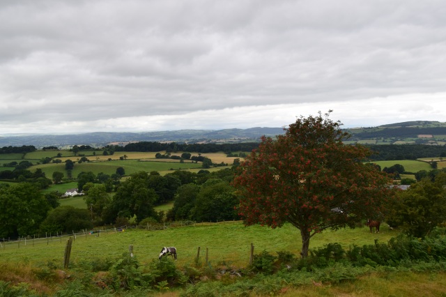
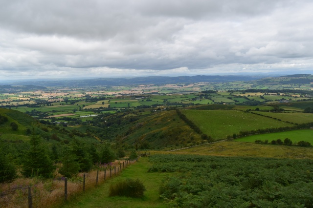
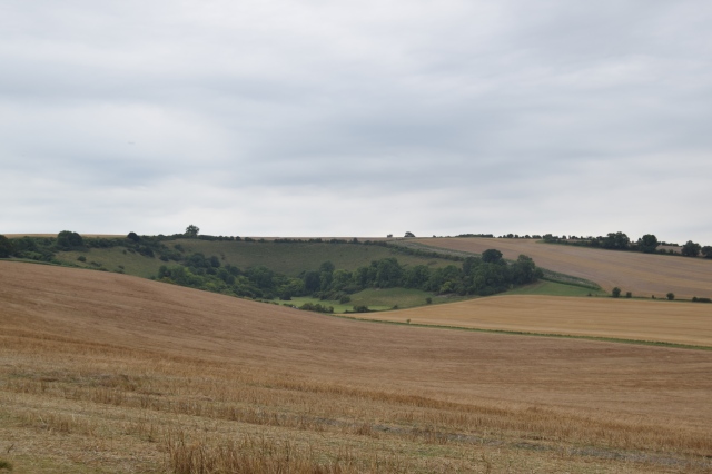
The next day I wanted to explore the nature of Latvia so I decided I would travel out to Sigulda and the Guaja National Park located about 30 miles Northwest outside of Riga or about an hour on the train. The National Park was the first National Park and reserve in Latvia and protects a beautiful and diverse area covering predominantly forest but also farmed countryside and some small bogs with small towns and settlements dotted around the park. Upon entrance to Sigulda, the town is very welcoming and people friendly. It is very traditional, peaceful, clean and calm. Many walking routes are available from Sigulda and these are easy to follow on descriptive route cards for all abilities. Sigulda and the area has been visited by many visitors both throughout history and in the present day.
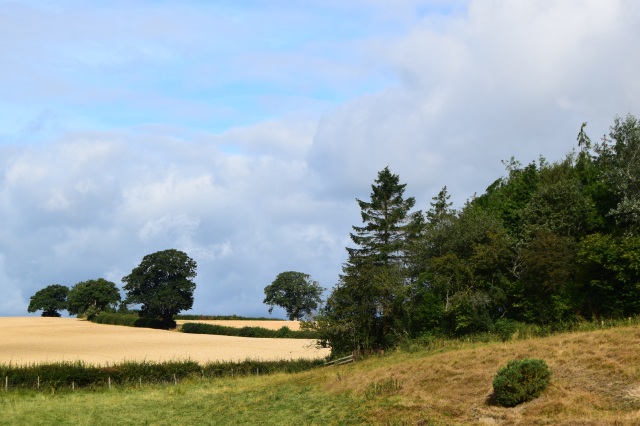
IMGP0061

Gauja Valley

My walk took me from the main road walking back towards Riga which then passes after a few hundred yards the national bobsleigh track for Latvia which appears going down into the Gauja Valley, and compromises of an interesting structure and somewhat unexpected. Following this it is possible from the road to see into the valley in both directions and admire a beautiful and amazing view of the unspoilt forest. Passing another activity centre then after on the next corner turning right I joined a small path around the back of a building. Leading a few hundred yards to a viewpoint. The valley becomes clear and it is possible to see dense forest and a combination of deciduous small white barked trees amongst coniferous giving the inside of the forest a huge variety and covering the valley in its entirety except for the deep wide River Gauja flowing directly through the middle carving a magnificent and beautiful valley. The path descends to the right via a steep slope and occasionally steps to reach the bottom of the valley and the riverside. The river is steady flowing and the valley allows emersion in nature and being at peace. The route I took lead me to follow the bank of the river downstream passing some boggy clearances but predominantly exploring the beauty of the forest and its peaceful surroundings. The forest on the river bed was also quite mossy showing the purity of this particular area. On the next bend in the river, a bare face of sandstone is present called the Devil’s Cliff. This is the largest bare faced cliff in the Baltics and is a beautiful feature of the river observed only from the side I was on and at a very tranquil spot, with the cliff being predominant and a combination of golden bronze sides of the cliff with its erosion providing an interesting and naturally beautiful cliff side and riverbank. Some small caves can also be observed amongst the dense forest sides. Continuing on along the tranquil river bank leads to a suspension bridge which I crossed to reach the other bank.

IMGP0062

River Gauja

IMGP0069

Devil’s Cliff

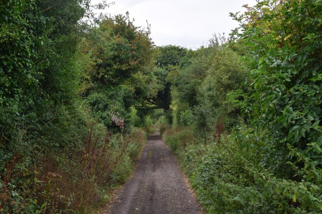
Next turn right lead me to a path which follows the river above the Devil’s Cliff and the path undulates through the forest with views on the river through the trees. Continuing to the inside of the meander leads to some small caves and interesting bogs. There is an array of plant life. The sandstone cliff continues above the path with interesting rock formations and springs. There was also an array of frogs in some of the pools. Retracing back slightly lead me to a staircase to the top of the cliff and after a very short section on the road I took a track on the right hand side following a forest track with the occasional break where farmland is present. The forest has occasional views over the river but the track also on looks at dense forest with purple flowers often littering the floor and a decent track which after about a mile and a half turns right and heads into Kirmulda.

IMGP0084

Forest on route to Kirmulda

The first signs of Kirmulda are in the form of traditional farmstead buildings. They are a combination of stone built and brick all formed together with corrugated metal roofs. They are slightly dilapidated in appearance but are beautiful and rustic at the same time and are similar to many rural buildings. The path passes rightward and then through the garden of Kirmulda Manor, a beautiful and large white building prominent on the landscape now used as for recovery. The path meets the road after passing the Cable Car and ends at the top of the Serpentine Road, which was built to enable easier access across the valley and also for a visit of a Russian Tsar. Continuing over the bridge brings one to the Kirmulda Castle Ruins which are interesting and show the foundations and part of the stone built structure. A stairway at the far side descends back into the bottom of the Gauja Valley then turn right to cross a stream left to pass two small lakes where a small snake was witnessed.

IMGP0095

Farm building near Kirmulda

A little further on brought me to the Gutmanala Grotto, the largest in Latvia. This cave is evident of tourism throughout numerous years and has been the subject of many local tales. The cave is impressive in the sandstone and stands out amongst other features with a small river running from the cave. It is 10m high, 12m wide and 18m deep inside.

IMGP0107

Gutmanala Grotto

After passing the grotto I headed on the path signing Turaida which goes up out the valley and through more coniferous forest. On the right hand side there are views across looking at the impressive brick faced Turaida Castle which is next to visit. When the path reaches Turaida heading across the car park is the entrance to the Turaida Castle and Museum. This ground compromises of a handful of traditional Latvian buildings, a church and gives a good insight into rural Latvian life past and present. The buildings are beautiful but quite rustic in appearance yet interesting to visit along with numerous exhibitions and sculptures. The main attraction is Turaida Castle with its impressive round brick tower rising above the valley. It provides amazing views over the River Gauja from the top. The castle and surrounding valley were important strategically in Latvia’s history and the castle compromises of a stone built structure covered in brick to give it its reddish look. Parts of the castle are being restored. The castle and exhibitions are interesting and give an insight into the history and structure of the castle and surrounding areas and are in numerous languages including English. It is defiantly a good attraction to visit.

IMGP0113

Turaida Castle

IMGP0125

View from top of castle tower down the Gauja Valley towards Sigulda

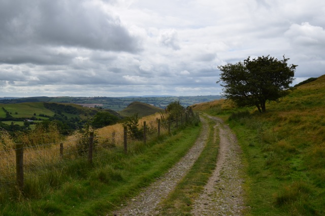
Leaving the castle, I retraced my route back into the forest taking a right turn at the first signed footpath junction to follow the top of the valley before descending back into the valley by Gutmanala Grotto. Following the river, I took the route following the road to cross the River Gauja again and turn right immediately after. The path then takes a cycle track up to Sigulda on the left hand side providing amazing views back to Turaida Castle and over the forested valley. Then heading leftward around the park at the top this follows to the stick park where sculptures of coloured sticks often associated in a traditional Latvian style are present. From here I headed past the bright white Lutheran church, an interesting, basic but impressive building. Continuing past brings to the castles of Sigulda. The New castle is an impressive large stone structure surrounded by a beautifully tranquil walled garden which includes sculptures. The old castle is in ruins but a lot larger in size and events are held in the castle grounds. Its grey stone structure can be visited and provides an impressive view up the Gauja Valley and it is another place of historical importance in this valley. After visiting the castles, I navigated my way back around the streets of Sigulda to the train station marvelling at this beautiful small Latvian town.

IMGP0150

Sigulda Lutheran Church

IMGP0154

Sigulda New Castle

For the third day I set off from Riga to Kemeri, about an hour’s journey by train. When Latvia was part of the Russian Empire, Kemeri was a major tourist resort surrounded by forest, nature and bogs popular with tourists in the past as a place of relaxation and healing due to the local water. Though parts of the town remain in a run-down state, parts of the town are filled with beauty and immense nature in the area. From going from the train station I headed down the road following signposts towards the tourist hut in the forest approximately 2 miles from the station. From here an impressive building greets you out of the forest.

The short board walk in this area the route I decided to follow first. This was the route around a boggy woodland and swamp. The area is very densely forested yet paths on this short route are clearly marked and so make as an easy walk accessible for all. The forest consists of a variety of species from coniferous and deciduous trees with small silver bark glinting out from the dense woodland. The bog is thick and deep but criss-crossed by small streams providing an interesting environment whilst other parts of solid ground consist of a green carpet and mosses common in Latvian forest. The area is peaceful and tranquil and a good platform to observe the nature of a unique environment. It could be likened to parts of the New Forest in the UK.

IMGP0171

Kemeri National Park near the Boardwalk

Following this short walk, I then preceded to do another walk of a short distance known as the Spring Trail. This starts at the main tourist office and heads back to the main road then continuing directly straight on. This route follows tracks marked with white and blue markings showing the correct trail. The peacefulness and purity of the air is immense and is great to observe the forests beauty occasionally broke by the odd bog and ground around switches from being a small green layer to bog and dense mosses. One also cannot help but notice a wide variety of fungi of various varieties throughout the route both on trees and at ground level. At the first footpath marker turn right to go further into the forest. At the next marker I turned left to head away from Kemeri. After following the track some more by an old abandoned building the main track ends and at this point in the backdrop a sulphur spring is observed dishing out a strong potent smell filling the air and water discolouring the water into an array of gold, yellow and white some of which is deposited at the side of the river, this adding interest to the walk. Kemeri is a spa town and the high content of sulphur made use as an aid in the towns attraction as a key resort. After visiting the spring, I retraced my steps to the last junction and took the track into Kemeri.

IMGP0182

Tracks in the forest on route to the Sulphur Spring

IMGP0185

Water from the sulphur spring

As I had a short while until the train I decided to explore this town which consists of residential buildings of rural Latvia, some grand buildings from the resort, a few attractions and a small handful of abandoned buildings. The first place I went and saw was another sulphur spring known as The Lizard. The sulphur well is contained in a bricked well covered by an ornate pagoda, with the lizard sculpture just below where it flows into the stream next to a small arched bridge. Nearby under restoration is the main resort hotel in Kemeri, a grand white building situated in peaceful park grounds currently under restoration. Passing through the grounds around leads to a grand orthodox church with blue and gold domes situated on a bright yellow and green building, ornately emerging from the peaceful and quiet wooded parkland. On route to the station I also passed another impressive Lutheran church constructed from light brown stone with the building having an interesting and vivid frontage.

From here I headed back to the railway station and took the train to Majori, the centre of Jurmala which was a 30-minute journey on the railway towards Riga. Jurmala is a beach resort both historically in times of the Tsar and until this day and is by far the most popular in the country. From leaving the train station, the first place that I visited was the main High Street, a very clean, bright and vivid street filled with café’s, restaurants and shops. The buildings are a combination of modern and traditional, some painted bright colours, give a peaceful and calm atmosphere on the main street. I stopped off at one of the restaurants on the main street to sample a traditional beef stew which consisted of chunks of tender beef and the usual array of Latvian vegetables, differing by having little liquid and a large quantity of heart-warming melted cheese covering the top of the stew.  After stopping off for lunch I continued to the end of the main street, turned left and headed towards the beach.

The Baltic coast is known for being beautiful. At Jurmala the beach was amazing consisting of miles of white sand stretching all around the bay with deep blue sea. The edge of the beach is covered with an array of trees where the beach goes directly into the forest. There are very few signs of human intervention along the shoreline giving a very natural feel. Even in Jurmala the town is set back behind the woodland so it is still very natural. Despite being the main beach resort, it was quiet and is possible to very quickly be alone and have a segment of this amazing coastline to ones-self. I followed the beach for about 1.5 miles passing the green and glassed domed spa baths, famous and apparent on the front of the shoreline. Upon leaving the beach I headed across to the other side of the spit with views inland across a large reed bed and river. Before heading back, I passed another Lutheran church, again an impressive stone built and colourful structure. Another building was a vivid, outstanding, light blue Orthodox Church with a blue dome and lined with striking yellow and gold around the exterior. After passing these I headed back to the train station and back to Riga and the next day travelled home.

IMGP0213

Baltic Coast from Jurmala

IMGP0224

Baltic Coast from Jurmala

My short time in Latvia has been an amazing experience and I enjoyed every moment. Though small, it is a great and interesting country with a fascinating history and filled with many areas of natural beauty such as its coastline and woodland. The capital Riga is historic and a beautiful city filled with beauty and many attractions worth visiting and a great place to soak up the atmosphere of Latvian culture. The Gauja National Park explores nature at its best in Latvia and is a place of great tranquillity, beauty and rural life with the area around Sigulda having many attractions and opportunities to experience rural Latvia. Kemeri also offers a chance to explore the nature of Latvia and a Latvian town. Jurmala the main beach resort offers a great coastal experience and a chance to explore the beauty of the Latvian coastline from this beautiful resort. Latvia is good for food and all the meals I had were basic but delicious and heart-warming. Latvia has an excellent culinary variety very different from the UK and coffee and alcohol are of good quality and taste. English is spoken well though speaking using a few simple phrases will be appreciated. It is also cheap to visit in comparison to the UK and many other European countries.

Latvia is undiscovered, yet is a great, beautiful and interesting country well worth a visit

Future ideas for should I visit Latvia again are long and I would love to explore more of the country and those that surround it in the Baltics. Firstly, Riga is a great and beautiful city and I would recommend at least two days, one to see sights and one to visit many museums which are interesting and give understanding to the history, culture and heritage of Riga and Latvia. I would also like to revisit and explore the Gauja National Park in more depth as there are so many interesting trails of various lengths in this beautiful segment of the country, (possibly a backpacking trip along the River Gauja from Sigulda to Cesis). There is also an urge to explore the more rural inland areas of Latvia off the tourist area and explore the beauty of this country in a greater depth. Finally, the Baltic States and coastline offer an opportunity for adventure in Latvia, Lithuania and Estonia and exploring  their cities and landscapes would create amazing trips.